
Ukrainian Dnieper Landings: Islands, Boats and Counter-Battery Fire
Ukrainian boats cross the Dnieper to secure delta islands. Lacking a bridge or heavy vehicles, gains are measured in meters under fire.
English · Original discussion in Spanish · Published
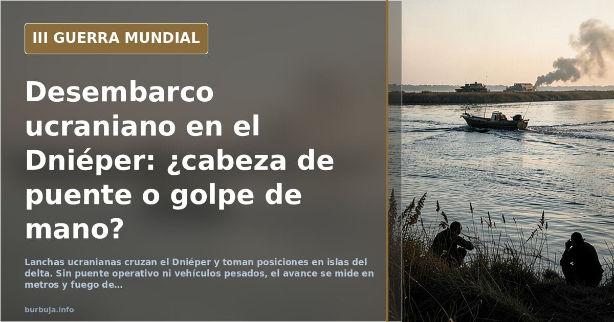
Ukrainian boats cross the Dnieper: The bridgehead the front line has yet to confirm
A handful of Ukrainian soldiers cross the Dnieper in boats and establish positions on the eastern bank, within the islet delta separating the two shores. The operation is reported as a multi-kilometer landing and a full-scale Russian retreat. However, the fine print of the source material downplays the report: there is no operational bridge, no heavy vehicles, and no deployed own artillery. It is a raid, not D-Day.
The debate begins with a message assuming a Russian withdrawal and ineffective Russian artillery. From there, opinions split: some see a probing operation with tactical value, while others view it as logistical suicide with a river at their backs. The most significant detail is not the advance itself, but what is missing to sustain it.
What is known about the landing on the east bank of the Dnieper
The original report mentions troops landing on the east bank and establishing positions along the shoreline, pushing back Russians, referencing an ISW report. The figure circulating in discussions is **10 km² seized at once**. Against this, a more technical reading nuances the terrain: the Dnieper, like all large rivers, has a delta with islets, and what is described as a landing is largely **crossing to one of those islands** and settling into the marshland.
The difference is not semantic. A beachhead requires logistical continuity; a delta island can be taken with boats and lost to two bombs. This introduces the disorienting fact: **the bridge is not operational**, one of the involved groups has been battered by artillery, and there is no capacity to move heavy vehicles. Without a bridge and without own artillery, what has been taken is a position, not a breakthrough of the front.
No bridge or heavy vehicles: The logistical bottleneck
The most repeated argument against the operation is textbook: crossing a river without a bridge or consolidated bridgehead is high-risk. On one side of the pocket is the front; on the other, a natural border that hinders supplies and prevents heavy support. With this geometry, opposing artillery works comfortably. The conclusion drawn is that **they will be shredded by shelling** if they attempt to consolidate.
The counter-argument also has military logic. Pinning down enemy troops, even few, means those troops are not elsewhere. If the movement forces reserves to move to a secondary zone, the cost for the defender is not zero. The problem is that this reasoning justifies the raid, not the bridgehead.
Counter-battery fire and glide bombs as response
The Russian response described in the material is not a retreat: it is fire. There are mentions of **two UMPK FAB-500s** launched against a fortified Ukrainian position on a Dnieper island, and artillery punishing the shoreline. The technical interpretation in discussions is that Russian artillery fires from cover, while Ukrainian pieces reveal their position when firing and are crushed. Hence the idea of **decoys** to force the opponent to reveal themselves.
This exchange explains why the advance is measured in meters, not sustained kilometers. It also explains skepticism about reports: whoever controls the sky and counter-battery decides how long an isolated position lasts. The figure of 10 km² may be true and still not miccionan what the headline suggests.
Raid, probe, or prelude to summer offensive?
The most prudent hypothesis appearing is that of a **probe**: a mini incursion to measure Russian defenses and force them to reveal themselves. The most ambitious speaks of an operation seeking to stretch the adversary before the real offensive elsewhere. The harshest labels it a senseless experiment sending young men to certain death.
None of the three can be closed with available data. What remains clear is the asymmetry: **Ukraine risks men in boats; Russia risks ammunition from covered positions**. In this exchange, the one crossing the river pays more dearly for each error.
Who controls the delta and why it matters for Crimea
The Dnieper delta is not just any point. It is the gateway to the eastern bank in the Kherson area and, therefore, the theoretical path south. Whoever controls the islands controls approach routes and observation posts. Thus, the movement has value even if not consolidated: **it forces defense of terrain that previously did not need defending**.
This also weighs on skepticism. If the area were so vital, the response would not have been only artillery and glide bombs. The absence of deployed brigades in the sector is read two ways: either there are insufficient troops, or command considers the risk does not justify moving them. Both readings leave the operation hanging.
The report that doesn't match the map
The conversation gets tangled in the usual issue: the colored map versus the official report. Some see humiliation for the adversary in the advance; others see a PR operation with human cost. The figure of 10 km² is repeated as proof, and the inoperative bridge is repeated as refutation. Neither datum is false. They simply measure different things.
Analysis stalls there. We know how much ground was trodden and how long the position lasted. We do not know how many men remain on the bank, nor whether command intends to hold it or use it merely as bargaining chip. Until that clarifies, the Dnieper landing is a tactical fact with a strategic operation narrative. And the river, meanwhile, remains the same river.
A handful of Ukrainian soldiers cross the Dnieper in boats and establish positions on the eastern bank, within the islet delta separating the two shores. The operation is reported as a multi-kilometer landing and a full-scale Russian retreat. However, the fine print of the source material downplays the report: there is no operational bridge, no heavy vehicles, and no deployed own artillery. It is a raid, not D-Day.
The debate begins with a message assuming a Russian withdrawal and ineffective Russian artillery. From there, opinions split: some see a probing operation with tactical value, while others view it as logistical suicide with a river at their backs. The most significant detail is not the advance itself, but what is missing to sustain it.
What is known about the landing on the east bank of the Dnieper
The original report mentions troops landing on the east bank and establishing positions along the shoreline, pushing back Russians, referencing an ISW report. The figure circulating in discussions is **10 km² seized at once**. Against this, a more technical reading nuances the terrain: the Dnieper, like all large rivers, has a delta with islets, and what is described as a landing is largely **crossing to one of those islands** and settling into the marshland.
The difference is not semantic. A beachhead requires logistical continuity; a delta island can be taken with boats and lost to two bombs. This introduces the disorienting fact: **the bridge is not operational**, one of the involved groups has been battered by artillery, and there is no capacity to move heavy vehicles. Without a bridge and without own artillery, what has been taken is a position, not a breakthrough of the front.
No bridge or heavy vehicles: The logistical bottleneck
The most repeated argument against the operation is textbook: crossing a river without a bridge or consolidated bridgehead is high-risk. On one side of the pocket is the front; on the other, a natural border that hinders supplies and prevents heavy support. With this geometry, opposing artillery works comfortably. The conclusion drawn is that **they will be shredded by shelling** if they attempt to consolidate.
The counter-argument also has military logic. Pinning down enemy troops, even few, means those troops are not elsewhere. If the movement forces reserves to move to a secondary zone, the cost for the defender is not zero. The problem is that this reasoning justifies the raid, not the bridgehead.
Counter-battery fire and glide bombs as response
The Russian response described in the material is not a retreat: it is fire. There are mentions of **two UMPK FAB-500s** launched against a fortified Ukrainian position on a Dnieper island, and artillery punishing the shoreline. The technical interpretation in discussions is that Russian artillery fires from cover, while Ukrainian pieces reveal their position when firing and are crushed. Hence the idea of **decoys** to force the opponent to reveal themselves.
This exchange explains why the advance is measured in meters, not sustained kilometers. It also explains skepticism about reports: whoever controls the sky and counter-battery decides how long an isolated position lasts. The figure of 10 km² may be true and still not miccionan what the headline suggests.
Raid, probe, or prelude to summer offensive?
The most prudent hypothesis appearing is that of a **probe**: a mini incursion to measure Russian defenses and force them to reveal themselves. The most ambitious speaks of an operation seeking to stretch the adversary before the real offensive elsewhere. The harshest labels it a senseless experiment sending young men to certain death.
None of the three can be closed with available data. What remains clear is the asymmetry: **Ukraine risks men in boats; Russia risks ammunition from covered positions**. In this exchange, the one crossing the river pays more dearly for each error.
Who controls the delta and why it matters for Crimea
The Dnieper delta is not just any point. It is the gateway to the eastern bank in the Kherson area and, therefore, the theoretical path south. Whoever controls the islands controls approach routes and observation posts. Thus, the movement has value even if not consolidated: **it forces defense of terrain that previously did not need defending**.
This also weighs on skepticism. If the area were so vital, the response would not have been only artillery and glide bombs. The absence of deployed brigades in the sector is read two ways: either there are insufficient troops, or command considers the risk does not justify moving them. Both readings leave the operation hanging.
The report that doesn't match the map
The conversation gets tangled in the usual issue: the colored map versus the official report. Some see humiliation for the adversary in the advance; others see a PR operation with human cost. The figure of 10 km² is repeated as proof, and the inoperative bridge is repeated as refutation. Neither datum is false. They simply measure different things.
Analysis stalls there. We know how much ground was trodden and how long the position lasted. We do not know how many men remain on the bank, nor whether command intends to hold it or use it merely as bargaining chip. Until that clarifies, the Dnieper landing is a tactical fact with a strategic operation narrative. And the river, meanwhile, remains the same river.
Also available in: Deutsch
Summary of a discussion on Burbuja.info - Foro de economía, actualidad y política., translated from Spanish and reviewed before publication. Read the full discussion (86 replies).
More summaries
-
Ukrainian offensive in Kherson, 'a fiasco,' according to a forum user
One sector deems Ukraine's Kherson offensive defeated, with thousands of casualties and lost armor; others deny it. Outcome open.
-
Russia withdraws from Kherson, shifting front toward Crimea
General Surovikin proposes moving defense to the Dnipro's left bank; Shoigu approves retreat. Kherson is no longer under Russian control.
-
Kherson under pressure: Ukrainian counteroffensive reaches 11 km from city
Ukraine's southern offensive brings fighting within 11 km of Kherson, while attacks on Russian collaborators surge in the occupied city.
-
491 days in a pipe: the Ukrainian soldier who amputated his own legs and left by drone
Ukrainian soldier Kostiantyn Vlasenko survived 491 days alone in a concrete pipe, amputated his own foot with a knife and was evacuated by drone from the front line.
-
Russia's Unupdated Casualty Count Stalls at 498
The Kremlin reported 498 soldier deaths and hasn't updated the figure. Without independent verification, casualty counts remain acts of faith.
-
EU arms Ukraine as Moscow threatens to strike convoys
The EU establishes an arms procurement cell and mobilizes Madrid's satellite center. Moscow warns it will attack European supply lines.